Polaris Sensor Technologies, Inc.
Polaris Sensor Technologies, Inc.
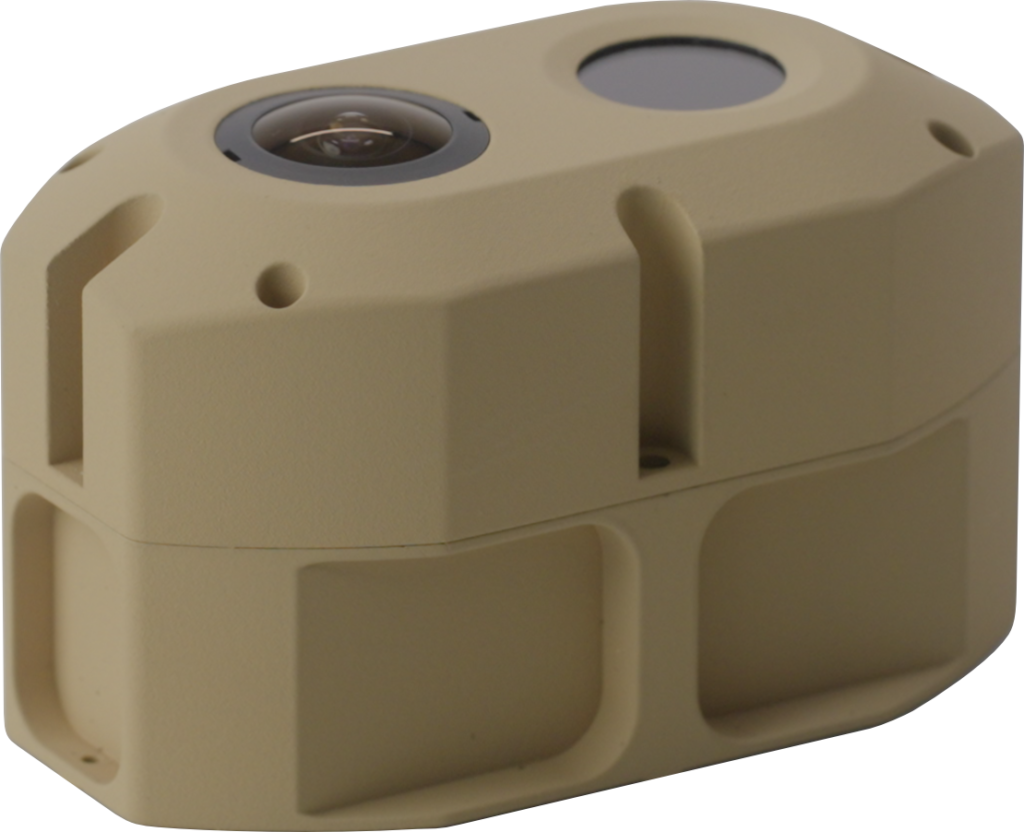
SkyPASS is north-finding in challenging conditions, with less than 2-mil heading accuracy and 4-mil pitch/roll accuracies. It provides absolute positioning so you can make important navigation decisions without GPS.
Because it’s driftless, spoof-proof, and not affected by magnetic disturbances, you can count on SkyPASS in difficult situations. 24/7 operation ensures that it’s always working to bring you home safely, even in civil twilight or at night.
Every second counts when you’re on the move. That’s why SkyPASS has an immediate time-to-fix, and there’s no setup or leveling required. It’s easy to install and integrate into your system or platform.
When it comes to mission-critical equipment, efficiency matters. SkyPASS is small enough to hold in your hand and requires low power to operate, making it easy to fit in existing systems and platforms.
With SkyPASS, you can navigate with confidence without breaking the bank. This system offers high-quality performance at a fraction of the cost of other GPS-denied navigation options.
SkyPASS can be used on almost any platform including UAS, vehicle, personnel, far-target locator, watercraft, and aircraft. It can be customized to fit your mission or platform as needed.
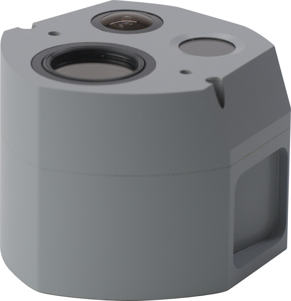


For thousands of years, humans have used celestial navigation to explore the seas and discover new territories, including the ancient Polynesians who skillfully navigated among the islands of the South Pacific* and the Vikings who used sky polarization to guide their ships.
Sky Polarization provides powerful navigation information that is used by many insects and birds to help them find their way.
SkyPASS which stands for Sky Position and Azimuth Sensing System, combines nature-inspired navigation techniques with cutting-edge technology to help you reach your destination safely. Utilizing sky polarization increases the availability of the system in twilight and in cloudy skies.
*https://www.worldhistory.org/article/1586/polynesian-navigation--settlement-of-the-pacific/
SkyPASS uses sky polarization, sun/moon, and star tracking to get an accurate heading and determine your position when GPS is lost, even in challenging conditions such as civil twilight or at night.

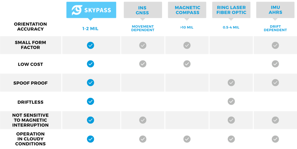
| SkyPASS | INS GNSS | Magnetic Compass | Ring Laser Fiber Optic | IMU AHRS | |
| Orientation Accuracy | 1-2 mil | Movement Dependent | >10 mil | 0.5-4 mil | Drift Dependent |
| Small Form Factor | • | • | • | • | |
| Low Cost | • | • | • | • | |
| Spoof Proof | • | • | • | ||
| Driftless | • | • | |||
| Not Sensitive to Magnetic Interruption | • | • | • | • | |
| Operation in Cloudy Conditions | • | • | • | • | • |
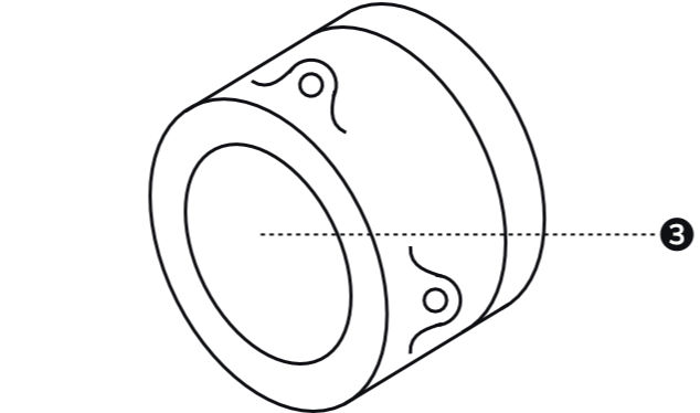
| Parts Legend | |
|---|---|
| 1 | Star Channel |
| 2 | Sun/Moon Channel |
| 3 | Sky Polarization Channel |
| 4 | Cable Connection |
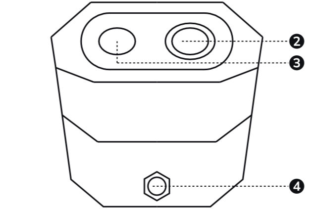
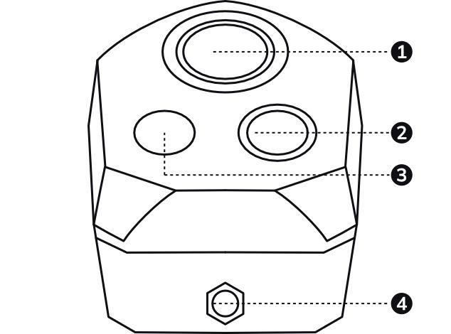
| SkyPASS Gen3-P1 | SkyPASS Gen3 | SkyPASS Gen3-N | |
| Status | In-Development | Available | In-Development |
| Optical Sensors | Polarization | Polarization, Sun | Polarization, Sun/Moon, Star |
| Time of Day | Limited Daytime, Civil/Nautical Twilight | Daytime, Civil/Nautical Twilight | Daytime, Civil/Nautical Twilight, Night |
| Sky Conditions | Full Operation in Clear Skies, Limited Operation or Degraded Accuracy in Haze/Fog/Clouds | ||
| Environmental | Designed to IP67 | ||
| Heading Accuracy (static) | <2 mil (0.11º) | ||
| Heading Resolution | 0.2 mil (0.01º) | ||
| Heading Accuracy (dynamic) | <4 mil (0.23º) | ||
| Roll/Pitch Accuracy | <4 mil (0.02º) | ||
| Size - L x W x H (in) | 1.49 x 1.49 x 1.18 | 3.5 x 1.9 x 2.4 | 4.1 x 3.9 x 3.2 |
| Weight (oz) | 1.76 | 8 | 20 |
| Max Measurement Frequency (Hz) | - | 1 | |
| Power Draw (W) | - | 4.1 | |
| Input Voltage (VDC) | - | 5 | |
| Interface | - | RS232, RS422 | |
Whether you’re piloting an aircraft, sailing over the ocean, or even on foot, SkyPASS helps you navigate safely to the next destination—no GPS required.
Polaris is here to help you solve challenging problems with cutting-edge technology. We will design, develop, and manufacture the solution you need to complete your mission.